| Tweet |

Custom Search
|
|
 
|
||
|
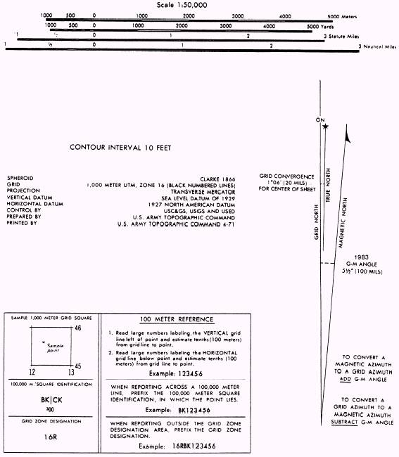
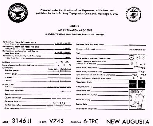
MAPS A map is a small-scale, flat-surfaced representation of a part of the surface of the earth. Man-made and natural features are shown by the use of symbols, lines, colors, and forms. (See fig. 5-1.) Maps show the location and distances between ground features, such as towns, populated areas, roads, airfields, streams, and other lines of communication. They also indicate variations in the landform and the height of natural features.
Figure 5-1.-Portion of military map-Continued. Some of the types of maps you will use areas follows: l TOPOGRAPHIC MAP. This map portrays terrain and landforms in a measurable form as well as the horizontal positions of the features represented. The vertical positions, or relief, are normally represented by contours. On relief maps, the elevations and contours are measured from a specified vertical datum plane, usually mean sea level. l PLANIMETRIC MAP. This map presents only the horizontal positions for the features represented. The omission of relief in a measurable form distinguishes it from a topographic map. Figure 5-1.-Portion of military map-Continued. l PHOTOMAP. This map is a reproduction of an aerial photograph or a photomosaic made from a series of aerial photographs. Photomaps show grid lines, marginal data, place names, route numbers, important elevations, boundaries, approximate scale, and approximate direction. l PICTOMAP. A map on which the photographic imagery of a standard photomap has been converted into interpretable colors and symbols. |
||
|
||