|
||
|
|
||
| |||||||||||||||
|
|
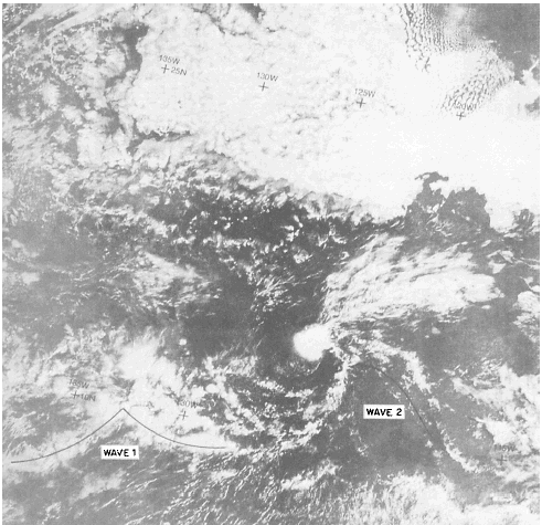
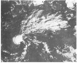
Click here to Order your Radar Equipment Online Easterly (Tropical) Waves In the tropics, spiraling (vertical) cloud patterns occur in the formative, mature, and dissipative stages of tropical cyclones, while weak tropical waves are often identifiable by curved cloud lines, spiraling cloud bands, and/or inverted-V- shaped cloud patterns that form east of these waves. Figure 10-3-10 shows the inverted-V-shaped pattern. This figure also shows another distinctive and characteristic feature of many weak, NON-DEVELOPING waves. The feature is known as the "screaming eagle" cloud pattern, and it can be seen above the second wave of the inverted-V-shaped cloud pattern. The broad wing-like pattern is also shown in figure 10-3-11.Tropical Cyclones Satellite pictures provide the earliest warning of tropical cyclone existence and permit a highly accurate tracking capability. Initially, a tropical cyclone is simply a dense mass of cumuliform, cir-riform, layered middle clouds without a recog-nizable shape or pattern. Its the size and location of these cloud masses that make them suspect to tropical cyclone classification.A suspect cloud mass has an average diameter of 3 degrees latitude or more except when the
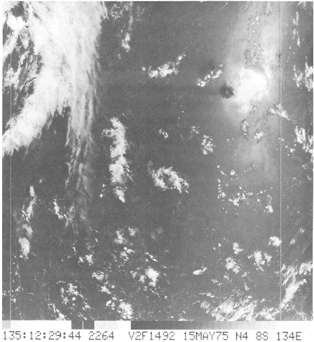
Figure 10-3-9.Sun glint in southeast Pacific.
Figure 10-3-10.Inverted
V-shaped pattern of tropical wave.
Figure 10-3-11.Detail of screaming eagle cloud cloud, mass is within or adjacent to the ITCZ of the Atlantic, Pacific, or South Indian oceans. Here, the diameter must average at least 6 degrees latitude. In the Arabian Sea and Bay of Bengal, suspect cloud masses must attain a diameter of 8 degrees latitude or more. All satellite pictures and any surface and upper-air observations from an area of suspicion are studied to determine whether tropical cyclogenesis is taking place. Recognizable cloud patterns evolve as tropical cyclones develop, intensify, and weaken. In the early stages, the clouds take on the shape of curved bands or lines. Cloud bands are usually seen 36 hours before a disturbance reaches tropical storm force. During this prestorm period, the cloud pattern is highly variable. Frequent, short period, mainly diurnal changes occur, which can cause a disturbance to appear quite intense during the day and much weaker at night. As a tropical cyclone reaches tropical-storm force, the cloud bands become more organized. At the weak tropical-storm stage, the band(s) curve halfway around the center of the system. As the storm intensifies, the banding completely surrounds the center, forming an eye, at the weak hurricane/ typhoon stage. Further intensification is indicated by increasing clouds around the eye, or by the eye becoming more well defined. |
|
Privacy Statement - Press Release - Copyright Information. - Contact Us - Support Integrated Publishing |