| Tweet |

Custom Search
|
|
 
|
||
|
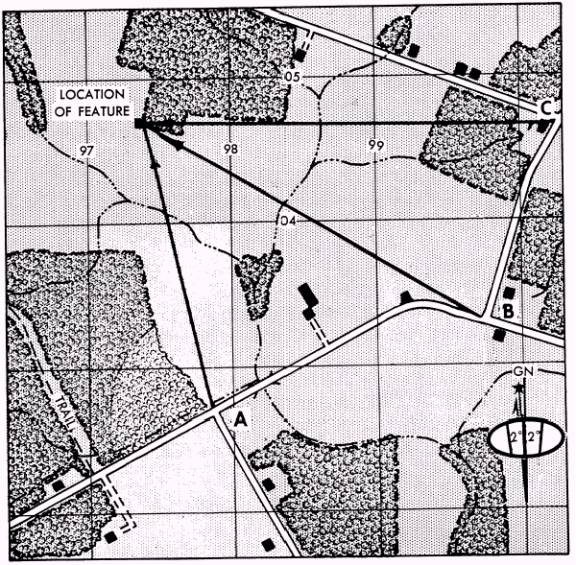
Intersection Locating an unknown point by successively occupying at least two, but preferably three, known positions and sighting on the unknown point is called intersection. It is used to locate features that are not defined on the map or which are not readily identifiable. The two methods of intersection are the map and compass method and the straightedge method. MAP AND COMPASS METHOD.- Study the following steps to locate an unknown point using the
Figure 5-36.-Intersection using map and compass. map and compass method of intersection. (See fig. 5-36.) 1. Orient the map using the compass. 2. Locate and mark your position (Point A) on the map. 3. Measure the magnetic azimuth to the unknown position; convert it to grid azimuth. 4. Draw a line on the map from your position on this grid azimuth. 5. Move to a second known position (Point B) from which the unknown point is visible. Locate this position on the map and again orient the map using the compass. 6. Repeat Steps 3 and 4 above. 7. As a check on accuracy, move to a third position (Point C) and repeat Steps 1 through 4 above. 8. The point where the lines cross is the location of the unknown position. Using three lines, you sometimes form a triangle instead of an intersection. This is called the TRIANGLE OF ERROR. If the triangle is large,
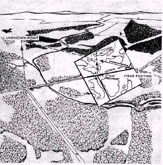
Figure 5-37.-Intersection without compass. recheck your work to find the error. Do not assume that the position is at the center of the triangle. |
||
|
||