Custom Search
|
|
 
|
||
|
MAP SCALES AND CONTOUR INTERVALS A topographic map is called either large scale, intermediate scale, or small scale by the use of the following criteria: Large scale: 1 inch= 100 feet or less Intermediate scale: any scale from 1 inch= 100 feet to 1 inch= 1,000 feet Small scale: 1 inch= 1,000 feet or more. The designated contour interval varies with the purpose and scale of the map and the character of the terrain. Table 8-1 shows the recommended contour intervals that you may use to prepare a topographic map.
Figure 8-28.-Contour (cut and fill).
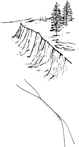
Figure 8-29.Cliff. |
||
|
||