|
||
|
|
||
| |||||||||||||||
|
|
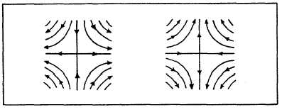
Click here to Order your Radar Equipment Online Analysis Procedures As with any weather analysis, you must look to the past to better understand the present. Make sure past history is transferred onto the current streamline chart. In streamline analysis the past locations of cyclones, anticyclones, waves, neutral points, and asymptotes of convergence and divergence are marked using a yellow pencil. Your next step is to evaluate the plotted data for obvious errors. The last preliminary step is dependent on your access to real-time satellite pictures. Pictures coinciding with your chart time should be examined. Before drawing your first streamline, you should tentatively locate and mark (in pencil) the center positions of anticyclonic and cyclonic centers and their associated neutral points. Also, mark the center positions of tropical depressions, storms, and hurricanes/typhoons according to information taken from appropriate advisories or warnings, and label the centers with standard symbology. Note that each of the above features is a singular point. Draw the streamlines in the same manner as any other cyclonic circulation. However, do not forget that on upper-level charts (300- or 200-mb), the wind flow changes from cyclonic to anticyclonic. As hurricanes track northward and enter midlatitudes, the stream-line analysis is dropped and a contour (pres-sure) analysis is begun. It is up to the command to determine at what point the switch is made.
Figure 9-2-12 illustrates the low-level streamlines
associated with a hurricane and the switch from
streamline to contour analysis. A recommended area in which to start drawing
streamlines is at the base of the subtropical ridge
line. The wind flow in this area is fairly straight
(undisturbed). These winds are the trades, and
they are the dominant feature of most tropical
streamline analyses. Draw a few streamlines
through this area first. Then, analyze the major
features in the subtropical ridgethe anti-cyclones,
and neutral points. Upon completing
this, locate and draw streamlines within any other
extensive area of undisturbed wind flow. Your
next step is to look for cyclones and their
associated neutral points. Asymptotes are then
drawn to these singular points and also to areas
of confluent and difluent winds. After all major
features and asymptotes are drawn, sketch
additional streamlines until a smooth and con-tinuous
pattern of wind direction is established.
You should remember that some interpolation is
almost always required in drawing streamlines.
Streamlines must parallel the wind arrows,
although some leeway is given in areas of wind
speeds that are 5 knots or less. The analysis of the wind field is incomplete
without the isotachs. They are dashed green lines
which, like streamlines, are first sketched in
pencil. They represent areas of equal wind
speed. Isotachs are drawn at 5-knot intervals
up to 20 knots, then every 10 knots thereafter.
Figure 9-2-13 is an example of an isotach pattern
typically found on a streamline analysis. The
major axes of isotach patterns tend to parallel
streamlines. The higher wind-speed areas show
elongated patterns, while areas of low wind speed
show a much broader isotach pattern. Color
coding is used to denote certain wind speed areas.
Areas with speeds 30 knots or greater are shaded
in purple, while areas with wind speeds of
10 knots or less are shaded yellow. In addition
to this shading, the terms |
|
Privacy Statement - Press Release - Copyright Information. - Contact Us - Support Integrated Publishing |