Order this information in Print

Order this information on CD-ROM

Download in PDF Format


Click here to make tpub.com your Home Page

Page Title: North american air masses, trajectories, and weather (summer)
Back | Up | Next

tpub.com Updates

Google


Web
www.tpub.com

Home

   
Information Categories
.... Administration
Advancement
Aerographer
Automotive
Aviation
Combat
Construction
Diving
Draftsman
Engineering
Electronics
Food and Cooking
Math
Medical
Music
Nuclear Fundamentals
Photography
Religion
USMC
   
Products
  Educational CD-ROM's
Printed Manuals
Downloadable Books


Back ] Home ] Up ] Next ]

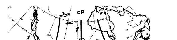
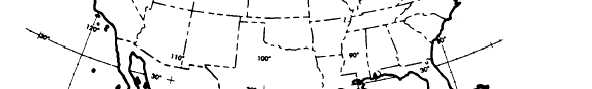
Click here to Order your Radar Equipment Online

NORTH AMERICAN AIR MASSES, TRAJECTORIES, AND WEATHER (SUMMER)

During the summer most of the United States is dominated by either S or mT air, whereas Canada and the northwestern United States are dominated by polar air. Occasionally, tropical air is transported to the Canadian tundra and Hud-son Bay region.


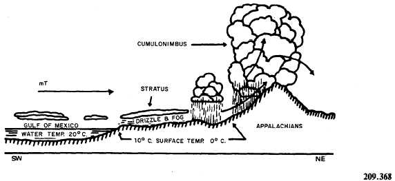
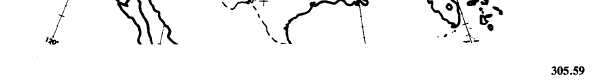
Figure 4-1-13.mT (Gulf of Mexico or Atlantic) air of winter moving northward over cold continent.


Figure 4-1-12.mT air moving northeastward.

Continental Polar (cP) Air in Summer

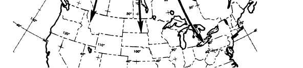
Continental polar (cP) air mass has charac-teristics and properties quite different from those of its winter counterpart. Because of the long days and the higher altitude of the sun (as well as the absence of a snow cover over the source region), this air is usually unstable in the surface layers, in contrast to the marked stability found in cP air at its source in winter. By the time this air reaches the United States, it can no longer be distinguished from air coming in from the North Pacific or from the Arctic Ocean. (See fig. 4-1-14.) Clear skies or scattered cumulus clouds with unlimited ceilings characterize this mass at its source region. Occasionally, when this air arrives over the central and eastern portion of the United States, it is characterized by early-morning ground fogs or low stratus decks. Visibility is generally good except when haze or ground fog occurs near sunrise. Convective activity, usually observed dur-ing the daytime, ensures that no great amounts of smoke or dust accumulate in the surface layers.

An exception to this is found under stagnant con-ditions near industrial areas, where restricted visibility may occur during the day and night. Pro-nounced surface diurnal temperature variations are observed in cP air during summer. The convective activity of this air is generally confined to the lower 7,000 to 10,000 feet. Fly-ing conditions are generally smooth above approx-imately 10,000 feet except when local showers develop. Showers, when observed, usually develop in a modified type of cPk over the southeastern part of the country. The base of cumulus clouds that form in this air is usually about 4,000 feet because of the relative dryness of this mass.

Maritime Polar (mP) Air Pacific in Summer

The entire Pacific coast is usually un-der the influence of mP air in the summer.


Figure 4-1-14.Continental polar (cP) air in summer.

(See fig. 4-1-15.) With a fresh inflow of mP air over the Pacific coast, clear skies or a few scat-tered cumulus are generally observed over the coastal mountains. As this air flows southward along the coast, a marked turbulence inversion reinforced by subsidence from aloft is observed. Stratus or stratocumulus clouds generally form at the base of the inversion. Ceilings are generally 500 to 1,500 feet with tops of clouds seldom above 3,500 feet. The formation of the stratus condi-tion along the coast of California is greatly enhanced by the presence of the upwelling of cold water along the coast. East of the Rocky Moun-tains, this air has the same properties as cP air.

Back ] Home ] Up ] Next ]


Privacy Statement - Press Release - Copyright Information. - Contact Us - Support Integrated Publishing

Integrated Publishing, Inc. - A (SDVOSB) Service Disabled Veteran Owned Small Business