|
||
|
|
||
|
Page Title:
Maritime Polar (mP) Air Atlantic in Winter |
||
| |||||||||||||||
|
|
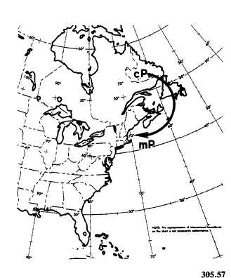
Click here to Order your Radar Equipment Online Maritime Polar (mP) Air Atlantic in Winter Maritime polar air, which originates in the Atlantic, becomes significant at times along the east coast. It is not nearly so frequent over North America as the other types because of the nor-mal west-east movement of all air masses. This type of air is observed over the east coast in the lower layers of the atmosphere whenever a cP anticyclone moves slowly off the coast of the maritime provinces and New England. (See fig. 4-1-10.) This air, originally cP, undergoes less heating than its Pacific counterpart because the water temperatures are colder and also because it spends less time over the water. This results in
Figure 4-1-10.Trajectory of mP air over the Atlantic in the instability being confined to the lower layers of this air. The intermediate layers of this air are very stable. Showers are generally absent; however, light drizzle or snow and low visibility are common. Ceilings are generally about 700 to 1,500 feet with tops of the clouds near 3,000 feet. Marked subsidence above the inversion ensures that clouds caused by convection will not exist above that level. The synoptic weather condition favorable to mP air over the east coast is usually also ideal for the rapid development of a warm front with maritime tropical air to the south. Maritime tropical air then overruns the mP air and a thick cloud deck forms. Clouds extending from near the surface to at least 15,000 feet are observed. Ceilings are near zero and severe icing conditions exist in the cold air mass. Frequently, freezing rain and sleet are observed on the ground. Towering cumulus clouds prevail in the warm air and often produce thunderstorms. Flying conditions are rather dangerous with mp air because of turbulence and icing conditions present near the surface. Poor visibility and low ceilings are additional hazards. The cloudiness associated with the mP air mass usually extends as far west as the Appalachians.
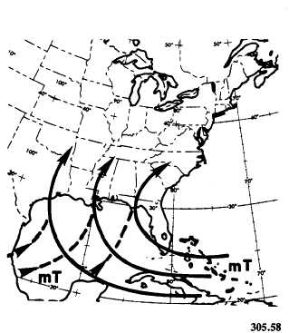
Figure 4-1-11.Trajectories of mT air over the Atlantic |
|
Privacy Statement - Press Release - Copyright Information. - Contact Us - Support Integrated Publishing |